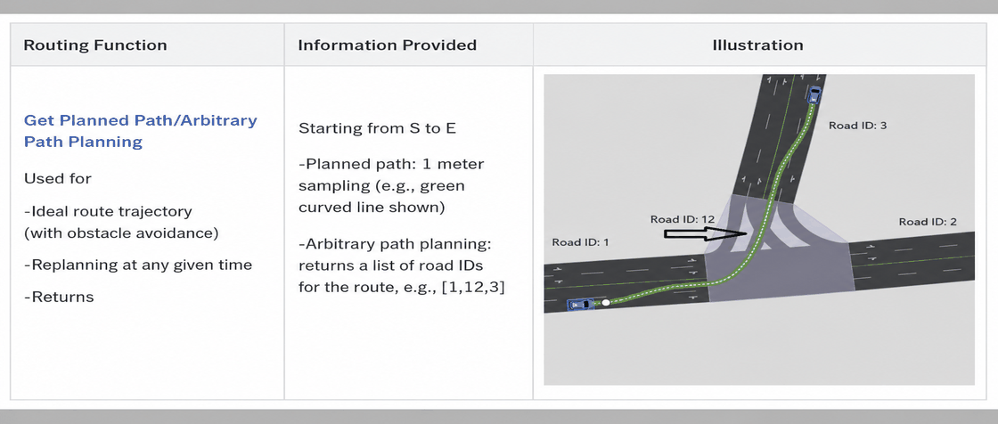
HD Map Runtime Classes
4.1 HDMapAPI
The HD Map road network runtime currently provides APIs for the following functions: global query, localization, routing, traffic lights and signs, and parking spaces.
4.1.1 Basic Concepts
(1) Coordinate Systems: The HD Map system provides two coordinate systems: Local ENU and s-t.
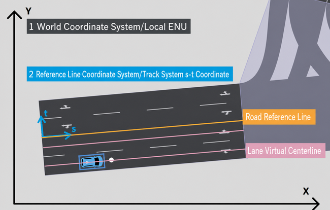
A. World Coordinate System / Local ENU The world coordinate system uses a right-hand x, y, z coordinate system.
Conventionally used for geographic reference (Local ENU): x points East (E), y points North (N), z points Up (U).
B. Reference Line Coordinate System / Track System s-t Coordinate
The road network runtime defines two s-t coordinate systems based on different reference lines:
-
s-t coordinate system based on the road reference line
-
s-t coordinate system based on the lane virtual centerline
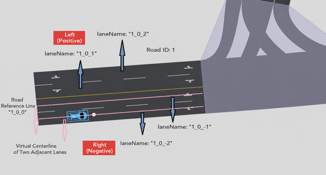
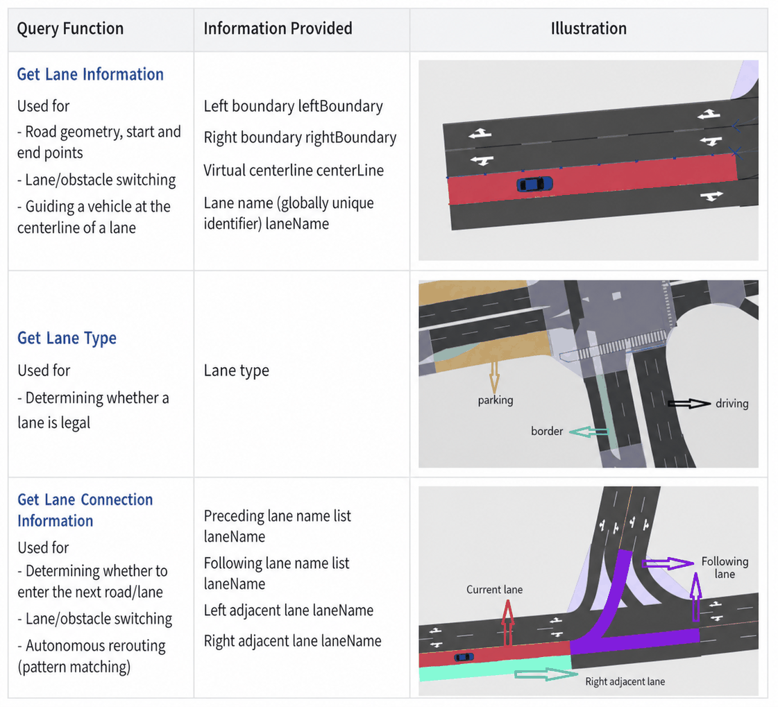
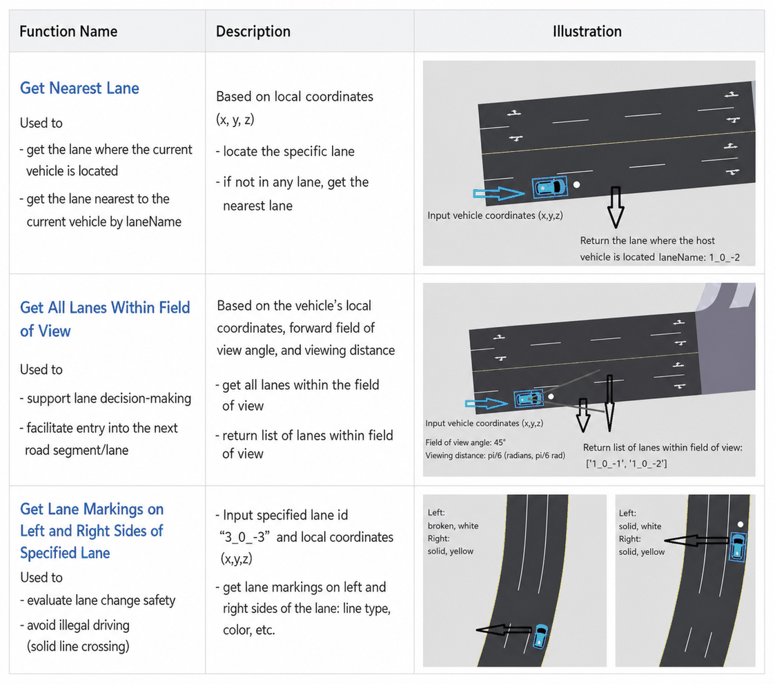
(3) Lane Identifier: The laneName in the HD Map provides a unique identifier for each lane, enabling precise lane queries and localization by combining the road ID, section index, and lane ID.
-
Identifier format:
$roadId_sectionIndex_laneId -
$roadId: The unique ID of the road. -
_sectionIndex: The index of a specific section within the road, used to identify different parts of the road. -
_laneId: The lane number, unique within each section.
Examples:
-
"1_0_-1"refers to the first lane to the right of section index 0 on road ID 1 (negative sign = right side). -
"1_0_2"refers to the second lane to the left of the same section (positive sign = left side).
(4) Coordinate Conversion: Converting between LocalENU (x, y, z) and [s, t] coordinates.
-
[s, t] coordinates in the Road reference line system
-
Definition: Uses the road reference line as the baseline. t is negative to the right of the reference line, positive to the left.
-
Example: P(-51.5, -73.5) corresponds to [s, t] = (7, -5.25) in the Road 1 reference line system.
-
[s, t] coordinates in the Lane virtual centerline system
-
Definition: Uses the lane virtual centerline as the baseline. t is negative to the right, positive to the left. When the Ego Vehicle travels along the lane virtual centerline, t is always 0.
-
Example: P(-51.5, -73.5) corresponds to [s, t] = (7, 0) for Lane "1_0_-2" and [s, t] = (7, -3.5) for Lane "1_0_-1".
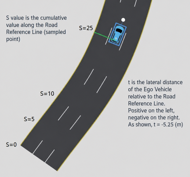
(5) Locating Obstacles: Using [s, t] coordinates in the Road reference line system, you can determine the lateral distance (t) and longitudinal distance (s) of an obstacle relative to the Ego Vehicle's direction of travel.
-
Definition: Uses the road reference line as the baseline. t is negative to the right, positive to the left. S is the cumulative distance along the road reference line.
-
Example: The Ego Vehicle's ST coordinate relative to the road is (25, -5.25).
4.1.2 Global Query
4.1.3 Localization
4.1.4 Routing