Appendix 1: System Conventions
4.1 Coordinate Systems
For high-definition maps, the system provides two coordinate systems:
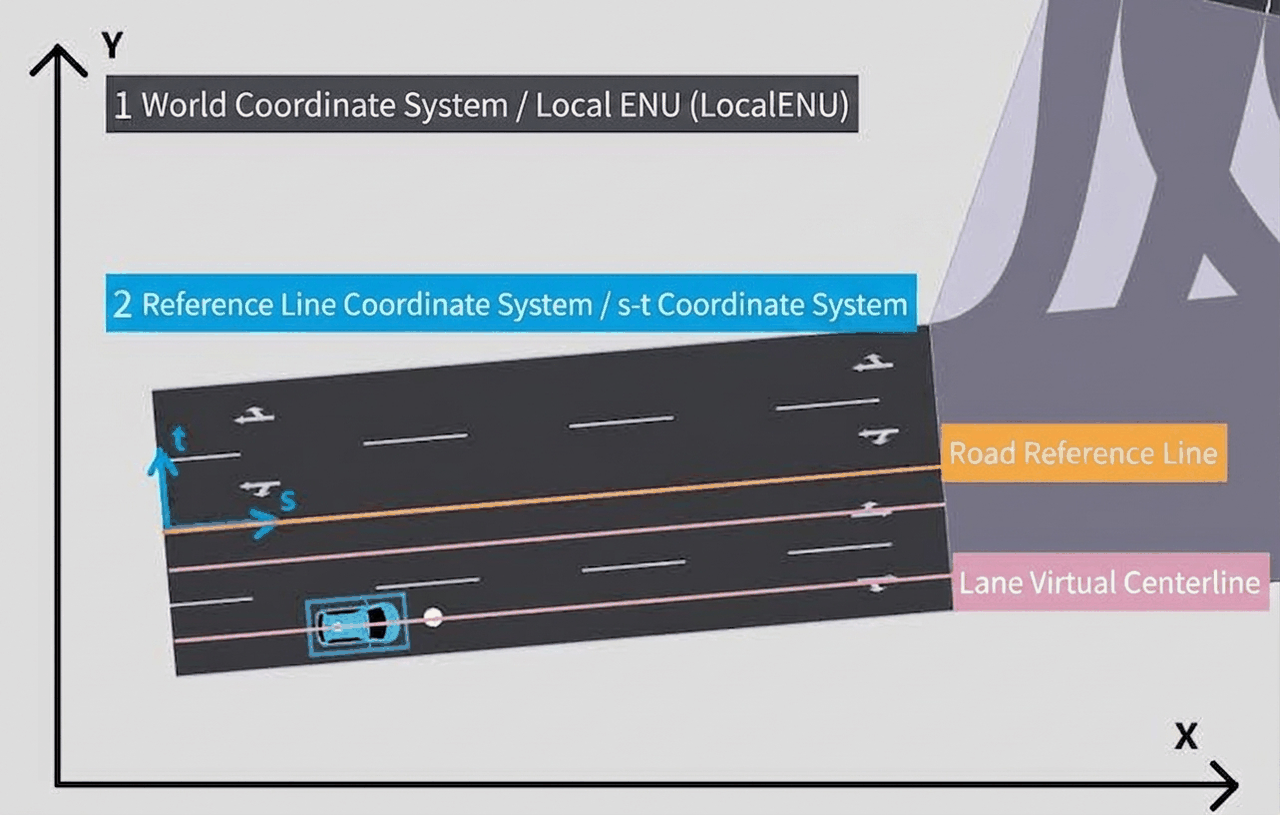
(1) World Coordinate System / Local Cartesian Coordinate System (Local ENU) The world coordinate system is a right-handed x, y, z coordinate system
The convention applies to georeferencing, i.e., corresponding to the local Cartesian coordinate system, where x points due East (E), y points due North (N), and z points Up (U).
(2) Reference Line Coordinate System / Track System s-t Coordinate (Track System s-t coordinate)
During road network operation, two s-t coordinate systems are defined based on different reference lines:
-
An s-t coordinate system defined based on the road reference line
-
An s-t coordinate system defined based on the lane virtual centerline
4.1.1 Spatial Cartesian Coordinate System
-
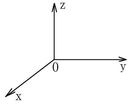
Coordinate Axes: Select an arbitrary point O in space. Through point O, draw three mutually perpendicular number axes Ox, Oy, Oz, all with O as the origin and sharing the same unit of length. These three axes are called the x-axis (horizontal axis), y-axis (vertical axis), and z-axis (elevation axis).
-
Spatial Cartesian Coordinate System O-xyz: Their positive directions conform to the right-hand rule, i.e., grasp the z-axis with the right hand such that when the four fingers rotate 90° from the positive direction of the x-axis toward the positive direction of the y-axis, the thumb points in the positive direction of the z-axis, forming a spatial Cartesian coordinate system.
-
Origin: The fixed point O is called the origin of the coordinate system.
The left-handed spatial Cartesian coordinate system is the counterpart to this. In mathematics, the right-handed spatial Cartesian coordinate system is more commonly used.
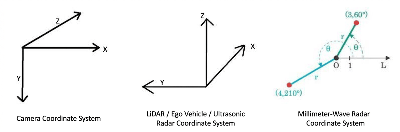
4.1.2 Sensor Coordinate System
4.2 Units
| Category | Name | English Name / Abbreviation | Unit | Description / Remarks |
|---|---|---|---|---|
| Physical Quantities | Length | Length | m | Meters, used to represent position information |
| Angle | Angle | rad | Radians, used to represent the offset angle of an object relative to a center position | |
| Speed | Speed | m/s | Meters per second, used to represent speed, acceleration, angular velocity, etc. | |
| Rotational Speed | RPM | r/min | Revolutions per minute, used to represent wheel speed, engine speed, etc. | |
| Control Parameters | Throttle | Throttle | Unitless [0-1] | 0 means no throttle; 1 means full throttle |
| Brake | Brake | Unitless [0-1] | 0 means no braking; 1 means brake fully depressed | |
| Steering Wheel | Steering | Unitless [-1, 1] | -1 means full left turn at 540°; 1 means full right turn at 540° | |
| Steering Wheel Mode | ESteeringMode | Unitless | Represents the magnitude of the steering wheel in percentage, torque, or angle | |
| Status Information | Handbrake | Handbrake | - | true or false, indicating handbrake engaged or released |
| Gear | EGearMode | - | Represents the gear state of the vehicle, such as P, N, D, etc. | |
| Object Type | SimOne_Obstacle_Type | - | The type of object, such as vehicle, pedestrian | |
| Traffic Light Status | SimOne_TrafficLight_Status | - | Traffic signal light status, such as red light, green light | |
| Signal Data | Signal-to-Noise Ratio | SNR | dB | Decibels, a unit for measuring the ratio of signal strength |
| Radar Cross Section | RCS | mdb | Used to represent the electromagnetic wave radar cross-section scattering area | |
| Data Specifications | Point Cloud Format | Point Step | - | Data specification of point clouds, such as 16-line, 32-line |
| Detection Probability | Probability | Unitless [0-1] | Object detection confidence output by the prediction model | |
| Bounding Box Information | bbox2d | Coordinate Information | Used to describe the coverage range of an object in an image or space |